9/13/2551

Khao Luang Naional Park


General Information
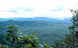
The Park, located on the southern peninsular of Thailand in Nakhon Sri Thammarat province is Khao Luang National Park. It is named after the tallest mountain in the park which is also the tallest in southern Thailand. The park is mountainous with many tall mountains along this range.
Geography
The Park covers an area of 570km encompassing a huge variety of wildlife, including mountains, forests, rivers and waterfalls. Providing a place of beauty for visitors to come and experience. This area also provides an important watershed area for the surrounding villages and farms. Park provides a green roof to southern Thailand and its quality earned it an award in 1999 for being a place of outstanding beauty and nature. Park was officially designated a National Park on the 18th December 1974, becoming the 9th National Park in Thailand. The Headquarters of the Park is 30km from the town of Nakhon Sri Thammarat. mountainous Park is a watershed for the Tapee River. It is located within several districts; Lansaka, Chawang, Phiboon, Plomkiri, Chang Klang and Nop Pi Dam.
Climate
Due to the Parks location on the peninsular, it receives monsoons from both the east and the west coasts and means that the Park receives a great deal of rain all year and also cold weather. There are two main seasons. Rainy season from May through to January with the heaviest of the rainfall between October and December. Hot season is between February and April. Over the year the Park receives approximately 3,500-4,000mm. of rainfall. The highest temperatures range between 28-30 Celcius and the lowest between 15-17 Celcius in January and February.
Flora and Fauna
Moist Evergreen Forest, which can be found in the valleys and in damp gulleys and riversides. Hill Evergreen Forest and Lower Montane Forest,Over 300 species of orchids can be seen within the Park. Khao Luang is the only place in the world where some of these can be found. There are no less than 327 species of animals living in Khao Luang, some of these include; Malayan Tapir (only seen if you are very lucky), Sumatran Serow, Pigtailed Macaque, Bush-tailed Porcupine, Clouded Leopard, Barking deer, Sambardeer, Binturong, Panther, Tiger, Wild Pig, Banded Languar and Dusky Speckled Languar. Bird species include, Black Eagle, Red Jungle Fowl, Great Argus Pheasent, Crested Fireback Pheasent, White-crowned Hornbill, Bushy-crested Hornbill, Great Pied Hornbill, Helmeted Hornbill, Redcrowned Barbet and Sunbirds.

Hat Wanakon National Park

General Information
Hat Wanakon is the 18th and currently newest Marine National Park in Thailand (1995). It was opened by royal decree on 30th December 1992. The park covers a total area of 38km2 which also makes it the smallest Marine National Park. The park is relatively close to Bangkok being 315kms south. Prior to becoming a National Park, Hat Wanakon was an Arboretum and Silviculture Station, and has long been associated with forestry. The park consists of a terrestrial and marine section, the landward part (59.5%) is dominated by beach forest and plantations. The marine section (40.5%) is nearshore sandy beach and the deeper water surrounding two islands 6km offshore.FolkstoryThe islands offshore of Hat Wanakon were created in a most macabre way according to a local legend. Once upon a time there was an old couple who had a young beautiful daughter. It occured that she was courted by two young men. One was a chinese boy who was of royal decent, the other a local boy from Phetchaburi. One of the suitors approached the father about marrying the daughter, while the other approached the mother. The parents did not realise that their daughter was being courted by two different men. On the day of the wedding, the two grooms arrived at the same time and this caused much trouble. The mother and father argued about which one should marry their daughter. The arguement was so heated that the father became very angry. He then blamed all the problems on his daughter. He was so angry he grabbed her and tore her in two (possibly half for each of the suitors)! One half he threw to the north, this part fell into the sea just offshore of Khao Sam Roi Yot to form Nomsao Island the other half he threw east and it fell into the sea near Chonburi to form Nomsao Island. (The Thai word Nom means breast and the word Sao refers to a young girl!). The wedding presents the father threw into the sea offshore, and today they form Chan Island and Thaisi Island.
Geography
Hat Wanakon is located on a narrow coastal plain which stretches from the mountains of the Tennessarim to the gulf of Thailand. The deposits are of Quaternary origin and consists of layers of material laid down in horizontal beds. The deposits are dominated by Quartz sands, with a partical size ranging from sand to pebbles. Some of the beds also have sandstone rock fragments. The particals in the beds show a degree of rounding probably produced by fluvial action. The degree of rounding, <40% href="https://blogger.googleusercontent.com/img/b/R29vZ2xl/AVvXsEhcdmBe69UuoThvK_ylHQbzM1YKo80r5r89X-COb3B08F_AghHTt-ElJzJh6coJ4E8PHeu-quNfZplPzhwtB_7Wo-OzYsla4PeMz-7rjMnMyp61ta5YbIe33VDymYCc1QU9uDLoEDZN3JI/s1600-h/NP55T1P23[1].jpg">These deposits can be clearly seen forming the cliffs surrounding Makha Bay.
Flora and Fauna
Vegetation Forest resource in the Hat Wanakon National Park is the mixed forest and generally, it's tall forest consists of bamboo, mikey tree, yang na, oramosia and pterocarpus. The former forest in the Hat Wanakon National Park is the replenished forest mixed together with recovered natural forest and replanted tree such as myrtle and lagerstroemia etc.Wild AnimalsWild animals were founded totally 61 types, many are edible-nest swiftlet, other wild animals are birds totally 48 types, and other kinds of 13 wildlifes such as jungle fowl, squirrel, treeshrew, lepus pequensis, skink, canis aureus, shake and porcupine etc.Sea ResourcesThere are a lot of aquatic animals such as shrimp, fish, coral, turtle some kinds of dolphin. In addition, around Chan island and Tai Tsea island, there is some beautiful coral reef and in the ocean also found the source of sea grass e.g. phom nang grass. While some rock area and plain along a beach is the natural place for incubating and growing of mussels.

Lam Nam Kok National Park

General Information
The area of Namtok Khun Kon Forest Park, Namtok Huai Kaeo-Bo Namron Huai Mak Liam Forest Park and Namtok Pong Phra Bat Forest Park., Chiangrai province, which have the site in the vicinity boundary. There is rather fertile natural condition but there are no support laws to administer so it was unable to develop the potential of the area and the main tourism spots for carry the expansion of a community, also with the tourists who travels into Chiangrai Province, which is the north important tourism border town, so the Royal Forest Department sent some of officers to survey Forest Park as mentioned and including National Reserved Forest area and in the vicinity area and on January 2001 started to explore a primary information and also sent some of the officers to control the area. On July 2001 and in the budget year 2002, the Royal Forest Department planned the program and the estimates to assume setting Lam Nam Kok to be a National Park including approval to construct the office buildings at the site of Huaimakliam watershed management unit office, in the local of Doi Hang sub-district, Mueang District, Chiangrai province. Permission using this area was from the Royal Forest Department on May 10, 2002.
Geography
Topography of Lam Nam Kok National Park is high sloped mountainous alternate narrow plain. North and south of the area is high downhill, the middle is river plain alternate the hill groove with 500-1,720 m high above msl. The main mountain ridges are Doi Yao, Doi Bo, Doi Chang, Doi Pha Mup etc. Maenam Kok is the main river of the north that the upper part flows through middle bottomland of the area. Head water start from Myanmar flowing pass the boundary of Thailand at Thaton sub-district, Chiangrai Province from the west to the east with total distance from Thaton to National park about 85 kms. Beside that there are many of streamlines which is born from the other mountain ridge in the area as Huai Mae Kon, Huai Mae Mon, Huai Yadi, Huai Chomphu, Huai San, Huai Mae Sai and Huai Lao-ai, these are confluence to be the main river and tributary to Maenam Lao and Maenam Kok, which are the main river of Chiangrai Province.
Climate
Chiangrai Province is in the site of monsoon zone, which received the influent of southwest monsoon wind in rainy season and northwest monsoon wind in the winter. It is able to separate obviously into 3 seasons as summer runs from March to May with average temperature about 38oC, Rainy season runs from June to October with average rain amount about 1,629 ml/year (1991-2000) and Cold season runs from November to February, December is the month with the bottom temperature about 5oC and there is the mist on summit of the hill all along cold season.
Flora and Fauna
Lamnamkok National Park composed 4 of forest types as Dry dipterocarp forest found distributes all the area to up 400-600 m from msl. Plant species found Shorea obtusa, S. siamensis, Dipterocarpus tuberculatus, Vietnamosasa ciliata etc. Hill evergreen forest found to up 800 m from msl on the summit of Doi Chang and Namtok Khun Kon Forest Park species found Quercus spp., Podocarpus neriifolius, Michelia floribunda, Rhododendron sp. etc. Mixed deciduous forest found most cover in the area at 50-800 m from msl. Plant species found Tectona grandis, Terminalia chebula, Millettia sp., Croton sp. etc. Dry evergreen forest found at 300-600 m from msl. The valley and a rim of the creek found Plant species as Dipterocarpus turbinatus, Anisoptera costata, Hopea ferrea, Aporosa aurea etc. Main wildlife group, which was found in this area, is mammalia as common muntjac, wild boar, civet, Asiatic brush porcupine, Siamese hare etc.

Mae Wong National Park

General Information
Formerly, Mae Wong National Park was the centre of hill tribe for example Hmong, Yao, Muzer and Karen. The park was declared a national park on 14th September 1987 as the 55th park of Thailand. This 894 km2 park is located approximately 350 kilometers northwest of Bangkok in the provinces Nakon Sawan and Kampaeng Phet, West Thailand.
Geography
The park is very rugged and hilly along Tanon Thong Chai mountain range, especially on the north and west. With the highest peak at 1,964 m. above sea level it is one of highest mountain ranges in the west of Thailand. Three main rivers of which the Mae Wong River is the biggest drain the park.
Climate
Weather in Mae Wong National Park can be divided into 3 seasons as follows : 1. Summer : during March - May 2. Raining : during June - October 3. Winter : during November - February which is mostly suitable for travelling.
Flora and Fauna
The park’s main area is covered by mixed deciduous, which has Tectona grandis, Afzelia xylocarpa, Pterocarpus macrocarpus and xylia kerrii as dominant tree. Evergreen forest is found among deep, wild pig, asiatic jackal, squirrels, civets and porcupine amongst others. And more than 450 species of bird that some in Thailand. More common mammals are barking Deer, Wild Pig, Asiatic Jackal, Squirrels, Civets and Porcupine amongst others. And more than 450 species of bird that some rare in Thailand.

Mae Wa National Park

general Information
Mae Wa National Park located in Mae Wa, Thoenburi , Lomrat, Mae Pa , Mae Mok, and Wiangmok sub-districts, Thoen district, Phrabatwangtuang sub-district, Mae Phrik district, Lampang province, and Wanchan sub-district, Samngao district, Maesalit sub-district, Ban Tak district, Tak province. It consists of complicatedly high mountains, productive forest which are the habitat of a great number of animals in many kinds, and wonderful places to visit such as Mae Wa Waterfall which has water flow all the year round and been well known by many people. Having convenient way to visit and locating only 19 km. from Thoen District Administration Office, Mae Wa National Park is about 587 square kilometers and has been declared a national park since November 17, 2000.
Geography
Mae Wa National Park, generally, is complicatedly high mountains. The north part consists of high and erected mountains while the middle and south part consists of mountain range which has vastly plain area on the top. The area has huge pine tree grow everywhere that makes this area is very beautiful. The west part of this area is Limestone Mountains high 300-400 meters above sea level.
Climate
The weather is tropical monsoon influenced by southwestern monsoon in rainy season and northeastern monsoon in winter. Rainy season starts in the middle of May to September which has heavy rain. Winter starts in October to the middle of February. Summer starts in February to the middle of May.
Flora and Fauna
The forest in the surveyed area consists of mixed deciduous forest, rainforest, dry evergreen forest and pine forest, all of which have valuable plants such as Makhaa Mong, ironwood, Burmese ebony, Lagerstroenia, rosewood, wild hog plum, almond-wood, laurel, Careya sphaerica Roxb, Anisoptera, Siamese sal, ingyin, as Pinus merkusii Jungh and Pinus kesiya Royle ex Gordon.There are a great number of wild animals, such as tiger, seladang, bear, buffalo, dear, barking deer, hare, frog, many kinds of fish, and birds such as hawk, coucal, and owl, because the area has the complicated mountains, productive forest, and food and water supply spreading all over.

Chae Son National Park

General Information
Jae Sawn National Park is a rich mountainous forest located in the northeast of Lumpang province. It is situated in the districts of Muang Bahn and Jae hom and covers an area of about 592 square km. The forest and mountains provide an important water source for the surrounding area. The Park has many interesting features including, waterfalls, caves and its famous hot springs. Along with many species of fauna and flora.All of this makes Jae Sawn an important place for tourism within Lumpang Province. Before Jae Sawn became the National Park it was a Forest Park which had two names Eang Nam Oun and Jae Sawn Waterfall The latter naming it after one of the Parks Waterfalls. Ministers approved the promotion of tourism in Lumpang province and the go ahead was given to convert Jae Sawn Waterfall into a National Park. Preparations were made from May 1986 to December 1987 for the celebration of the Kings 60th birthday at Jae Sawn Waterfall on the 5th December 1987. The Park was officially surveyed by Royal Forest Department staff soon after this and led to a decision by the board of directors, which in turn led to the Royal Decree that officially turned Jae Sawn into a National Park on 28th July 1988, becoming Thailand’s 58th National Park.
Geography
The national park is a mountainous area with 81 degrees Celsius hotspring over rocky terrain, providing a misty and picturesque scene.

Climate
Rainy season is from May to October, winterseason is from November to February and summerseason is from March to April. Usually, tourists canvisit the national park all year round.

Flora and Fauna
Mixed deciduous forest and deciduous dipterocarp blankets the park with various plants including Afzelia xylocarpa, Chukrasia tabularis, Toona ciliata,Diospyros pubicalyx, Lagerstroemia calyculata, Dipterocarpus alatus, Pinus merkusii, P.kesiya,Pterocarpus macrocarpus, Shorea obtusa, S.siamensis and D. obtusifolius.The park is home to animal such as CommonMuntjak, Mouse Deer, Common Wild Boar, AsianGolden Cat, Siamese Hare, Southern Serow, Malayan Flying Lemur, Langur, Macaque, Porcupine,Bear, Squirrel and Treeshrew. Various kinds of birds such as White-rumpedShama, Red Junglefowl, Woodpecker, Hawk, Bulbul,Barbet, Tailorbird, Green Pigeon, Warbler, Babbler,and Dove. Annually, there is a number of cicada conglomerating near the hotspring. People believe that theycome to consume mineral water here.